This project is not open for feedback. We’re simply informing the community about the upcoming works.
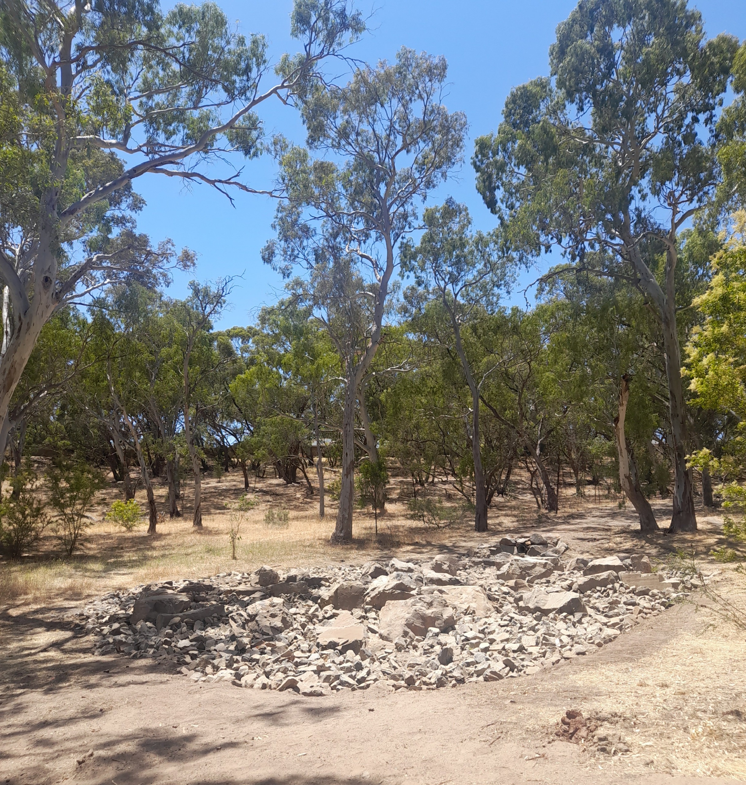
Construction completed
Construction is now completed, additional planting will occur at this site in the near future when weather conditions are more favourable.
Background
The City of Onkaparinga is planning stormwater work within the reserve off of Glenloth Drive in Happy Valley to improve drainage and reduce the risk of sinkhole formation.
The work involves extending the existing underground stormwater outlet pipe by approximately 100 metres further into the reserve. This will improve the management of stormwater flows into the site and support the long-term health of the reserve.
Key benefits of the works include:
- Discharging stormwater above the temporary wetland to preserve its ecological function and assist with groundwater recharge
- Releasing stormwater onto a flatter gradient to reduce erosion potential
- Protecting nearby Grey Box trees by directing flows away from their root zones
- The work will be done sensitively to minimise disturbance to the reserve. The project will also include the reinstatement of the adjacent section of walking trail near the existing sinkholes.
Project timing
The project is now currently scheduled to commence in January, subject to weather and unforeseen delays and will include the following elements:
- Extension of existing storm water conduit.
- Placement of score-reducing rocks and large boulders
Works will be undertaken between 7am-5pm Monday to Friday, excluding public holidays.
It is anticipated the construction works will take up to 3 weeks to complete, subject to weather and events outside of Council control.
Please note, there will be restricted access to the works area during the construction phase.
Concept plan
Download the concept plan

This image is a detailed project map titled “Glenloth Drive – Proposed stormwater upgrade”, created by the City of Onkaparinga. It shows the layout of planned stormwater infrastructure improvements between Glenloth Drive and Booth Street in Happy Valley (postcode 5159). A small location plan in the top right indicates the broader suburb context. The main map includes:
- Legend items identifying the extent of works (marked with a red outline), proposed planting zones (patterned areas), and stormwater pipes (black dashed lines for proposed, blue for existing to remain).
- Site access corridor marked with a dashed turquoise line connecting Booth Street to the work site.
- Tree protection zones outlined in circular overlays across the map.
- Multiple annotated labels describe elements such as sediment control, proposed pits, pipe connections, vegetation management, and erosion mitigation structures.
- The project area is primarily vegetated open space with overlayed planning zones.
- North is oriented at the top right, and the map is not to scale.


