Work is now complete
Thanks to everyone who provided feedback.
We're pleased to announce that work on the rumble strips is commencing in the week of 24 November 2025.
Completion timing will be dependent on weather and on-site traffic management will be in place during construction.
Background information
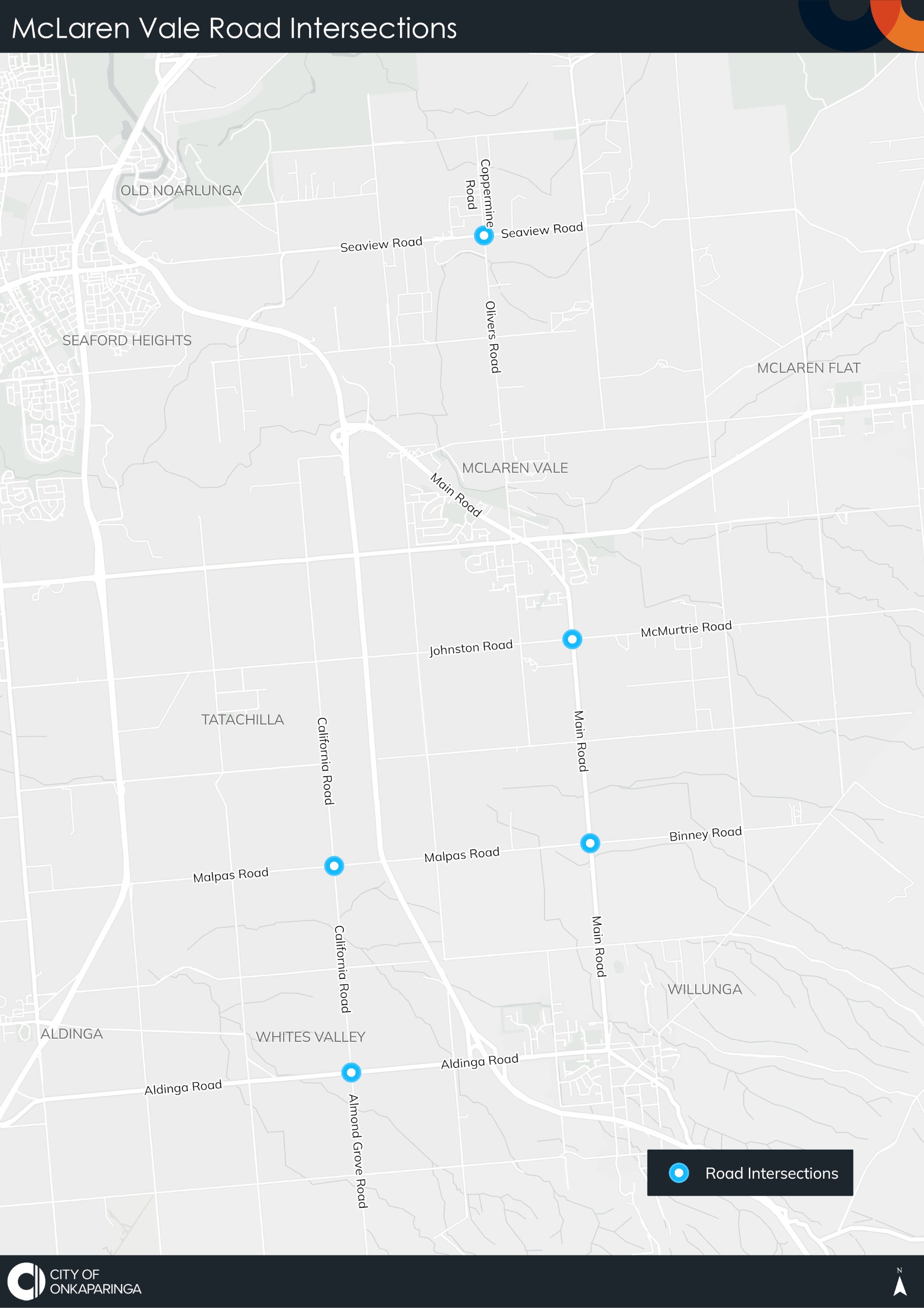
The City of Onkaparinga has been working with the Department for Infrastructure and Transport (DIT) to upgrade 21 intersections in the McLaren Vale region. This project is supported by a $4.2 million funding commitment from the State Government, secured through an election commitment by the Member for Mawson, Leon Bignell.
As part of the project’s final works, we are proposing to install rumble strips at five of the upgraded intersections. These additional measures were identified through a post-construction safety audit of all 21 intersections, which recommended further treatments to enhance vehicle safety.
Two different rumble strip designs are being proposed:
- DIT rumble strips
- The DIT rumble strip design consists of six raised asphalt strips, each approximately 14 to 18 millimetres in height.
- These will be spaced at 30-metre intervals, beginning 350 metres from the intersection and ending 200 metres before it.
- The strips are designed to provide both audible and physical feedback to drivers as they approach, improving awareness and safety.
- Austroads rumble strips
- The Austroads rumble strip design uses a resin-bound aggregate strip that is 200 millimeters wide and 7 millimeters high.
- Twelve strips are installed starting 200 meters from the intersection, with the spacing between strips progressively reducing from 17 meters to just 8 meters as the vehicle approaches the intersection.
- This spacing strategy increases the intensity of vibration and sound, enhancing the driver’s awareness as they draw closer to the intersection.
Read more about rumble strips in the frequently asked questions.
Click on the hotspot map to see which rumble strip design is being proposed for each intersection.
Click on the hotspots to view which rumble strip design is proposed for that intersection